This site attempts to predict whether the section of the new Waterfront Trail/Alaskan Way Bikeway at Bell St./Pier 66 is open or closed based on whether a cruise ship is currently docked at Pier 66.
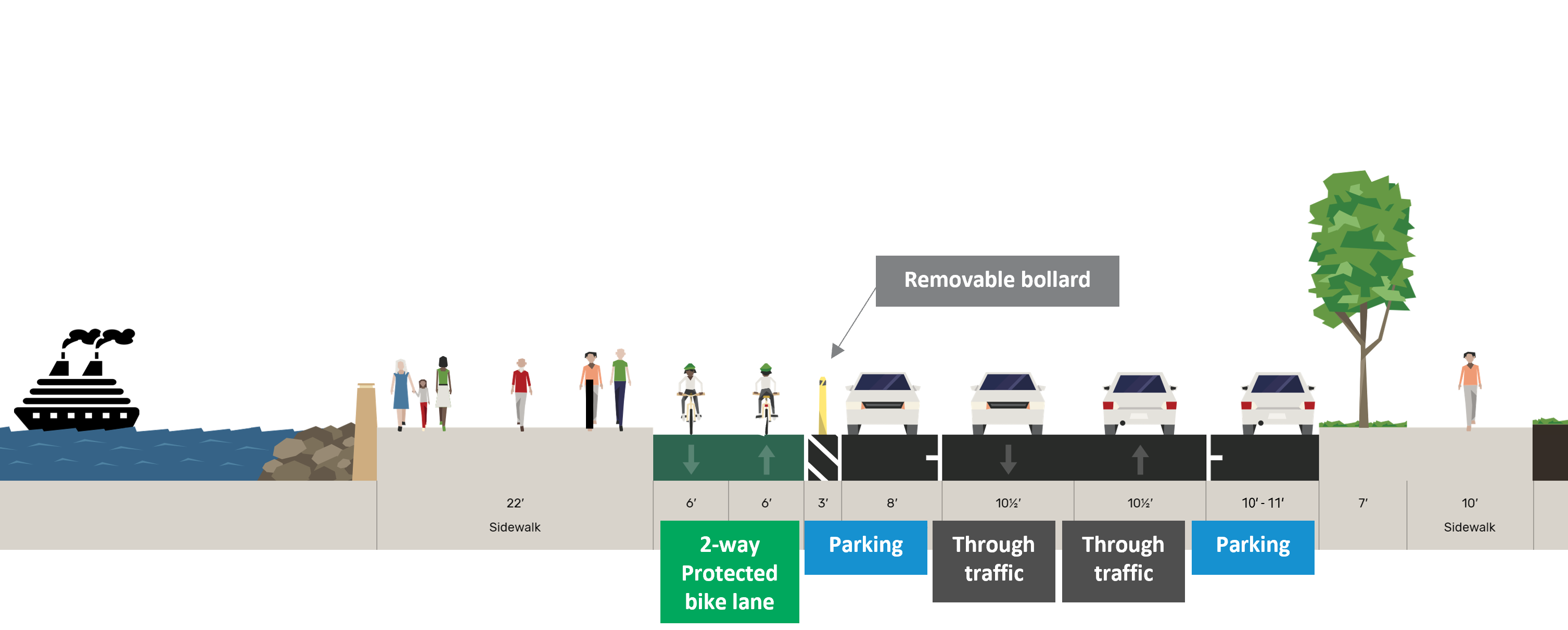
When designing this new bike trail, SDOT initially proposed leaving a two block gap in the trail around the Bell St. Cruise Terminal/Pier 66. This gap was intended to improve Port of Seattle cruise ship loading and unloading, but safe streets advocates called this potential gap in an important route "chao[tic] and danger[ous] for both pedestrians and people on bikes."
After community outcry, SDOT and the Port came up with a compromise: instead of year round chaos and danger, the route will only be dangerous and chaotic on the ~90 days per year that a cruise ship docks at Pier 66.
The site should be pretty accurate, but obviously pay attention for signs, barriers, and port employees, as those are the ultimate arbiter of whether the bikeway is open. When ships are departing, it seems the bikeway is reopened around 30 minutes before the ship pulls far enough away to trigger a status change on this site. I haven't been there early enough in the morning to verify, but I suspect the bikeway is also closed for a while before the ships get close enough to the pier for the status on this site to change to closed.
So it should be reasonably accurate but not perfect; it's also just a fun project with no promises on accuracy or uptime. If you want to plan ahead, the Port of Seattle cruise schedule shows which days cruise ships are scheduled to use Pier 66. Cruise season ends on October 19th, so the trail should remain open after that until April 2026 when cruise season starts again.